


When we last we last spoke, July was off to a hot start and we were just on the heels of a very wet, stormy June. Our July destiny already seemed to be set — it’d be another warm month with precipitation expected to be average to slightly above average. Wrong on both fronts. Mother Nature wins again! An abrupt pattern change during the last half of the month cooled us off so much that we come in 0.9-degrees below-average for the month, with an average temperature of 74.1-degrees. While we didn’t endure any prolonged dry-spells there were not quite as many heavy rain events in central Illinois in July as there were in June. July comes to a close 1.38” below-average with a monthly total of 3.32”. Let’s break it down a little further.
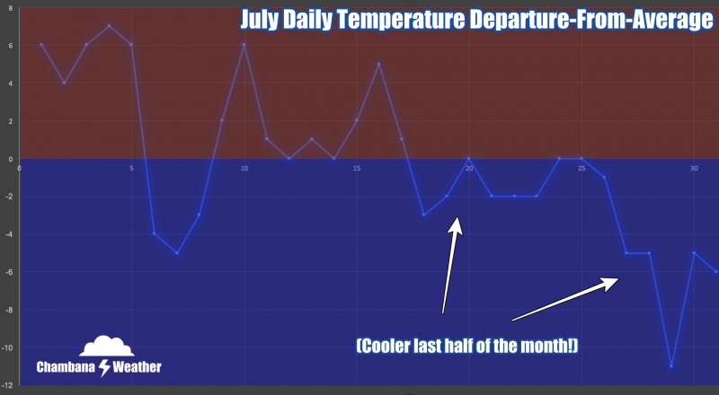
July started off hot. Of the first 17 days of the month, only three were cooler-than-average. That’s when the script was flipped. A ridge of high pressure that had been centered over the central U.S. keeping heat and humidity squarely rooted over the Midwest moved westward, taking the heat with it (you’re hearing about the heat in California now, while they battle huge wildfires). From July 18th to the 31st we never had another warmer-than-average day in Champaign-Urbana. During this cooler stretch, we also saw lower humidity and many beautiful overnights that were prime for opening the windows with lows in the 50’s at times. July 29th featured a high temperature of only 67-degrees, about 16-degrees below the average high temperature for that date!
July averages 4.70” of precipitation annually in Champaign-Urbana. We saw periodic showers and thunderstorms in the area during the month of July, but we didn’t cash in on the heavy rain opportunities that June presented. For many of our basements, that was just fine. The longest stretch without rain in Champaign-Urbana was only five days, but there were no daily precipitation totals over 1” — compare that with June when we had a stretch of three consecutive days exceeding 1” of rainfall. July was a quieter month for severe weather in Champaign County as well, after June brought tornadoes to parts of Champaign County. While a few storms did produce gusty damaging winds, no major severe weather occurred in Champaign-Urbana.
The future is rather unclear — to be blunt. I’ll give it my best, but meteorologists around the U.S. have been griping for the last couple of months at the stubbornness of this weather pattern refusing to give us any clues. It often advertises Weather Pattern A in the 2-week time range, only to make a sudden change and offer Weather Pattern B the very next week. Just look at the plot of temperature departures from average — the first half of July was spent mostly above-average while computer forecast models advertised heat to continue well into August. Then suddenly in mid-July we’re plunged into cooler mode for the remainder of the month with little advance warning of the pattern change.
Behind the scenes in the world of computer forecast models there was a point in time when August was being advertised as a total heat-wave across the Midwest. Now we’ve shifted back the other direction.
At this point, August looks about average on all-sides. I don’t yet see any reliable signal that we’re suddenly going to swing into heat mode, but it’s August, so that does always remain a possibility this time of the year. There’s simply no advertising of a pattern like that in the medium to long range forecast right now. There’s also no strong signal that we’re going to be locked into a cooler pattern either. I think we’ll fluctuate back and forth gently, coming out very close to average temperature-wise at the end of August.
We average 3.93” of precipitation during the month of August in Champaign-Urbana. I think we’ll come in near average, or slightly below average. There’s no indication that we’ll flip to a bone-dry weather pattern, but I also don’t see any major storm systems being advertised. If the ridge of high pressure continues to sit over the western U.S. as it is today, that will at least keep periodic chances for scattered thunderstorms in the picture in central Illinois. If that ridge decides to slide to the east however, that’s when we could be talking about a hotter and drier stretch in the Midwest. For now, let’s wrap this up with a call of near average temperatures and average to slightly below-average precipitation in Champaign-Urbana during the month of August. Get out there and enjoy the last of summer!
Andrew operates Chambana Weather, where he publishes daily weather information for Champaign-Urbana and surrounding communities. He is also an agricultural meteorologist with Agrible, Inc. at Research Park, focused on domestic and international weather and its impact on ag.
Champaign-Urbana monthly climate statistics are courtesy of the Illinois State Water Survey.
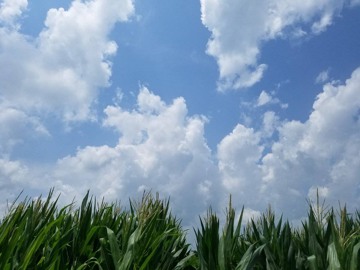
Photos by Andrew Pritchard