


The sun is setting noticeably earlier these days, and there’s no longer a hint of morning light when I wake up to put together the morning forecast. Kiddos are back in school, and farmers are beginning to plan their harvest. Where has the summer gone?
In my “summer so far” piece in early August, we talked about the ongoing drought in Champaign County, and the likelihood that we would see some relief as we transitioned from summer into fall. While Mother Nature and our weather know nothing of our silly calendar, sometimes it does feel like flipping the page to a new month is all it takes.
Out with hot and dry June and July, in with a cooler and stormy August!
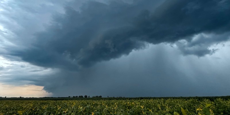
On August 1st, it finally happened — a thunderstorm with heavy rain finally broke through the invisible rain-shield that had been parked over Champaign-Urbana for the summer and delivered a badly needed drink. Just a few days later on August 4th, more thunderstorms brought up to two inches of rain to parts of the Twin Cities. Of course, as is the case with nearly all summer thunderstorms, rainfall totals were variable across the area and not everone saw relief right away.
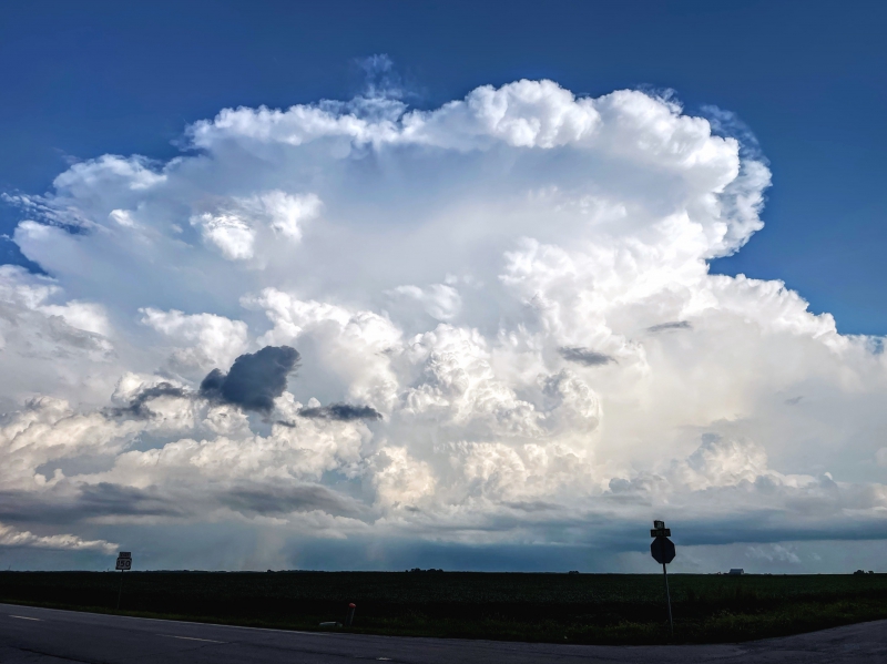
Photo by Andrew Pritchard.
Still, with a cadence of every four or five days, frontal boundaries settled into the Midwest bringing chances for showers and storms — and that’s just what it takes. Keep the fronts coming, keep the opportunity for rain in the forecast, and eventually we’re going to cash in.
By the end of August we had measured 4.94″ of rain at the Illinois State Water Survey on South First Street in Champaign — nearly an inch and a half above the monthly average. For the first time all summer, I had to mow the lawn in consecutive weeks!
Relief from hot temperatures was a little slower to follow. Afternoon high temperatures climbed into the lower 90s during the first week of August, but a shot of cool, dry air offered overnight lows in the 50s for the first time since late June. Following that shift, much of August offered up quiet, mild weather with temperatures generally near their seasonal averages. In fact, August was the first month all year that did not have a single day with temperatures more than 10 degrees warmer or colder than average.
Most days from August 9th through the end of the month featured highs in the middle 80s, and lows in the middle 60s. I found myself in a routine of running the air conditioner for a couple of hours in the late-afternoon, and then opening the windows before heading to bed that night. Pretty acceptable for August in the Midwest.
It follows then that the average monthly temperature for August was only 0.4 degrees warmer than average in Champaign-Urbana.
With August 2022 officially checking in at 1.40″ wetter than average with near average temperatures, I’m happy to all but consider us having shaken the hot and dry pattern that loomed for much of the summer. Another round of thunderstorms and a 2″+ rainfall event over the Labor Day weekend helped solidify that.
So where’s it all headed?
Well, after a little weekend rain you’ll really feel an early autumn chill early next week. A cold front is expected to send our temps around 10-15 degrees cooler by Monday, Sept 12th. That being said, a lot of our seasonal guidance suggests that warmer temperatures will again return to the Midwest by mid-September. There’s also growing evidence we could see one or two bigger storm systems work their way into the Midwest mid-month.
The summer-to-fall transition period is often one of low predictability as weather models struggle with many moving parts and an often complicated picture in the Northern Hemisphere.
As such, it’s sometimes easier to say what does not appear likely.
For now, there’s no evidence we’re going to plunge into any sort of September freeze. There also is no clear evidence we’ll suddenly flip to an extremely wet pattern. Instead, most long-range forecast guidance suggests we’ll keep things near or a little warmer than average over all, with a few more annoyingly hot days likely to come in the last two weeks of September. It’s unlikely we’ve seen our last 90-degree day of 2022, though I do believe they’re numbered.
We’ll likely continue to see chances for showers and thunderstorms accompany passing frontal boundaries every few days as well. I don’t expect much in the way of weather surprises from the rest of September in central Illinois.
I’d expect to be recapping a September that finishes a degree or two warmer than average, and a little on the wetter side of average.
Andrew operates Chambana Weather, where he publishes daily weather information for Champaign-Urbana and surrounding communities. He also serves as Senior Meteorologist with Nutrien Ag Solutions at Research Park, focused on domestic and international weather and its impact on agriculture.
Champaign-Urbana monthly climate statistics are courtesy of the Illinois State Water Survey.