


For all of the “must be nice to get paid to be right half the time” jokes that meteorologists endure, it’s only fair that we point out when we were correct as heck. At the end of my August recap I mentioned that most signs pointed toward a September that finished “near or a little warmer than average overall” and “a little on the wetter side of average“.
September 2022 in Champaign-Urbana comes in 0.2 degrees warmer, and 1.45″ wetter than average. Nailed it. I’m going on break for the rest of the year.
Now, just because September temperatures finished near average overall doesn’t mean we didn’t see plenty of variety.
Initially sticking pretty close to late-summer norms, September saw heat surge mid to late month with a max temp of 94 degrees on the 21st, part of a run of eight consecutive days that were 5+ degrees warmer than average. The first blast of autumn air arrived in the final days of the month with an overnight low of 41 degrees on the 27th. That’s September for you — anything from afternoon temperatures in the middle 90s to overnight lows flirting with frost.
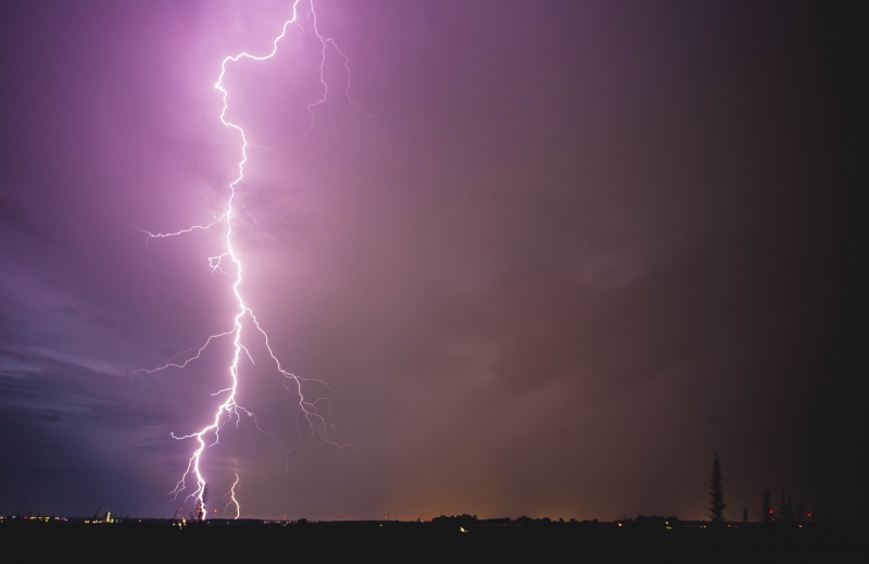
Photo by Andrew Pritchard.
Monthly precipitation for September in Champaign-Urbana finished at 4.82″, well above the September average of 3.37″. Still, it wasn’t quite what I’d call a rainy, or stormy month locally. Much of the precipitation fell on two days, September 5th and 19th. Storms on the 19th of September brought some of the most vivid, frequent lightning that I can remember. I woke up shortly after midnight to warnings being issued to our northwest and stepped out to the back porch to see non-stop flickering lightning on the horizon and a constant deep rumble of thunder. Oh baby. Heavy rain, some small hail, and gusty winds blew through Champaign-Urbana waking nearly every resident with a constant barrage of lightning before tapering off around 3 a.m.
Aside from these two 2″+ rainfall events, light rain of a quarter inch or less fell on six other days in September, with a whole lot of sunshine and blue sky days in between. Still, after a very dry May through July, we’ll take our August and September moisture any way we can get it.
As is typical in the seasonal transition months of spring and fall, predictability is rather low in the weeks moving forward. The jet stream pattern across North America will remain rather unfavorable for big storm systems sweeping through the Midwest, which makes dry conditions more likely at least through the middle of the month. A shot of cold air arrives this weekend with a couple of frosty mornings likely. Still, temperatures rebound next week with afternoon high temperatures returning to the 70s across Central Illinois.
And that’s likely what we’ve got in store for the month of October in Champaign-Urbana. Typical seasonal variation in our temperatures through the next few weeks, meaning we’ll see beautiful fall days with sunshine and temperatures in the 60s and 70s, and we’ll also see those first cold mornings with frosty windshields and overnight lows dropping down to the freezing mark. The pattern moving forward over the next few weeks will favor shots of cold air followed by rebounding fall warmth. All in all, between all the weekly, perhaps day to day and week to week variations, temperatures for the month probably finish very near the monthly mean.
Dry conditions are likely to persist for at least another week or two. As I mentioned above, the jet stream pattern over the next few weeks does not really support well developed storm systems moving through the Midwest. That means that any chances for rain are likely to be few and far between, and likely light in nature such as the showers we saw overnight October 5th-6th. Just enough to wet the pavement and top layer of soil. If we’re going to see a heavy rainfall event, or thunderstorms returning to central Illinois, it’s likely going to be in the last two weeks of October. None of this is out of the question, but based on the current look I’ve got to lean toward the drier side of average for the rest of the month.
So my call for October in Champaign-Urbana is for near-average temperatures and below average rainfall. For context, the average mean temperature in October for C-U is 54.9 degrees (highs in 60s/70s, lows in 40s/50s) and the October average for precipitation is 3.35″.
Andrew operates Chambana Weather, where he publishes daily weather information for Champaign-Urbana and surrounding communities. He also serves as Senior Meteorologist with Nutrien Ag Solutions at Research Park, focused on domestic and international weather and its impact on agriculture.
Champaign-Urbana monthly climate statistics are courtesy of the Illinois State Water Survey.