


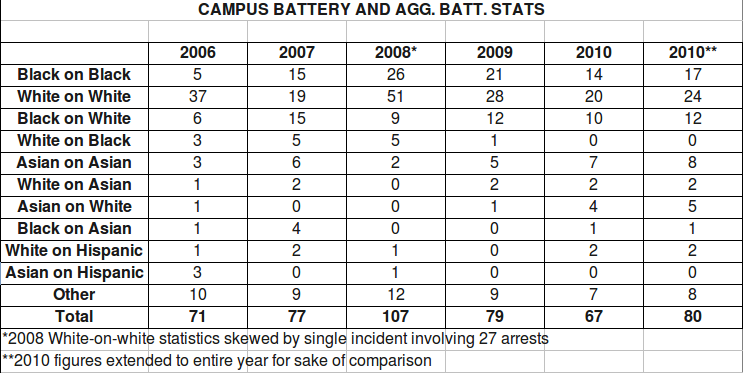
As a follow-up to last Monday’s article, Tim Green graciously volunteered to map the aggravated batteries in Urbana and Campustown over the last five years. As the UI Department of Public Safety provided demographic information for each case of battery and aggravated battery committed on campus between 2006-2010, some pictorial comparisons can be made. Scroll down to the bottom of the article for the campus-specific information.
Above, black-on-black incidents (average of 161 per year 2006-2009 and 132 through October 2010) are isolated. To see any of these maps in a larger size, right-click and select “View Image.”
The Champaign police department provided some additional battery data, but it appeared to be mixed in with other crimes (there were a total of more than 1,700 crimes listed per year, which is about three times the number of batteries and aggravated batteries which they’d previously supplied). The CPD didn’t respond to some questions requesting clarification by press time, so there really isn’t anything new to share on that front.
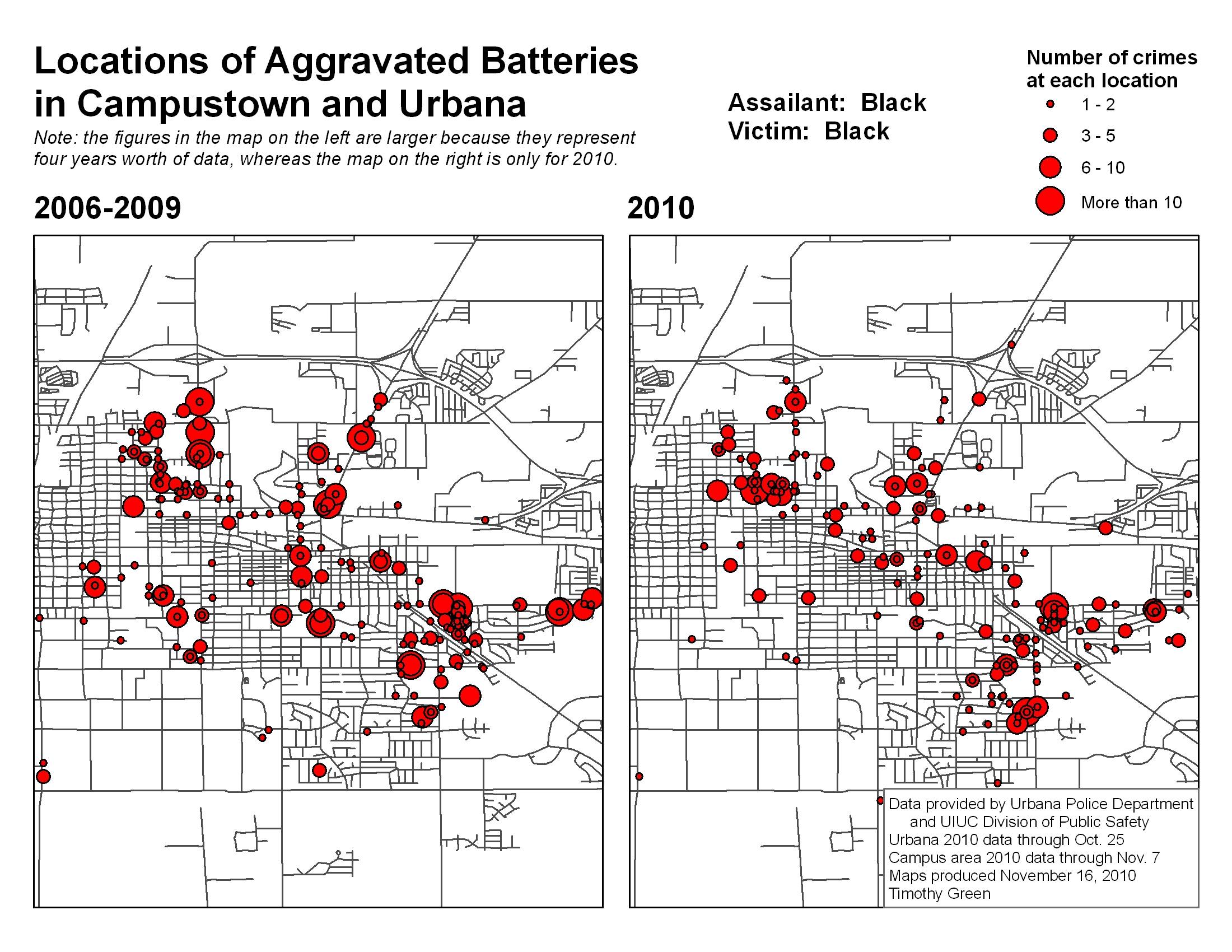
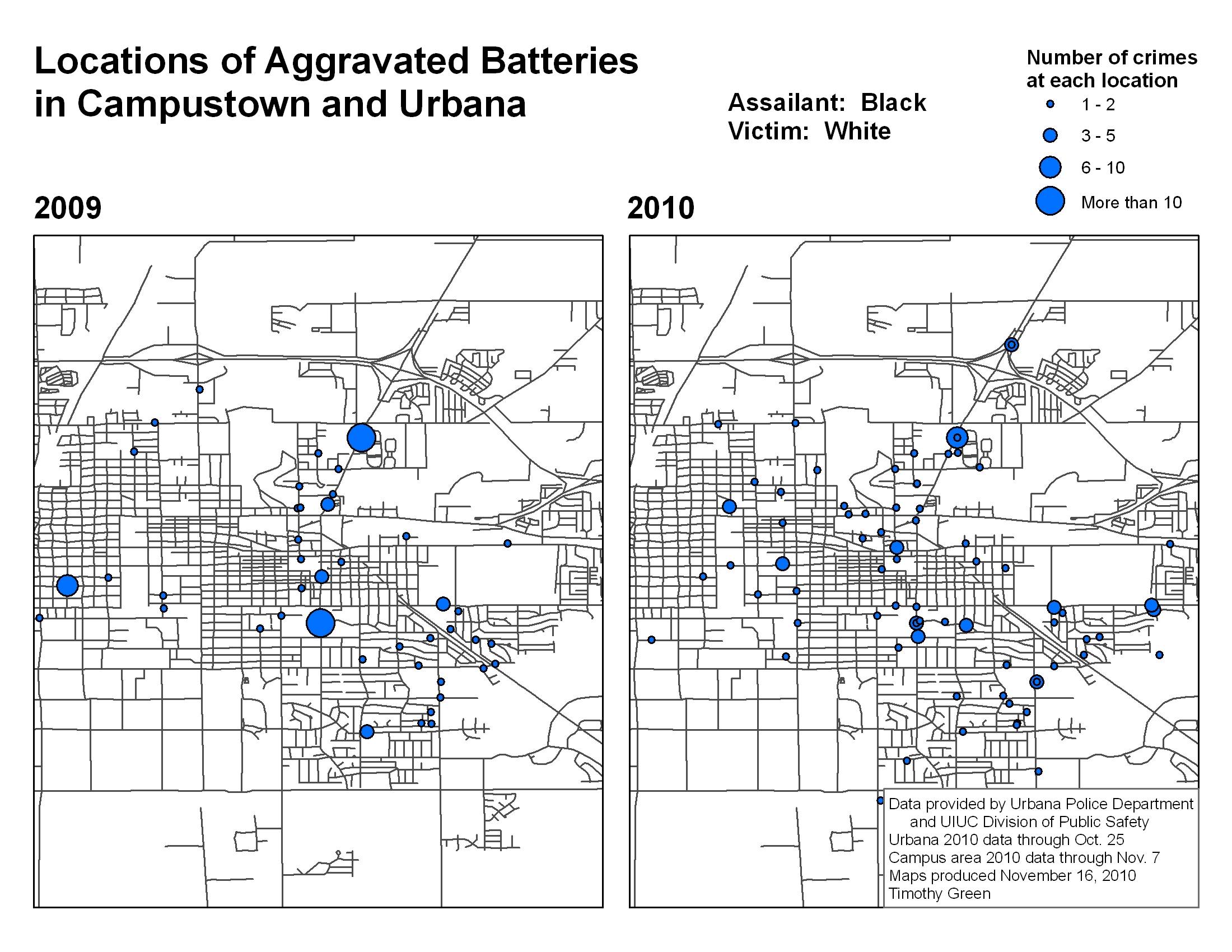
Below, you can see the locations of black-on-white incidents in 2006-2009 compared to 2010, and then below that, a year-to-year comparison of 2009 (91 crimes) and 2010 (86 crimes).
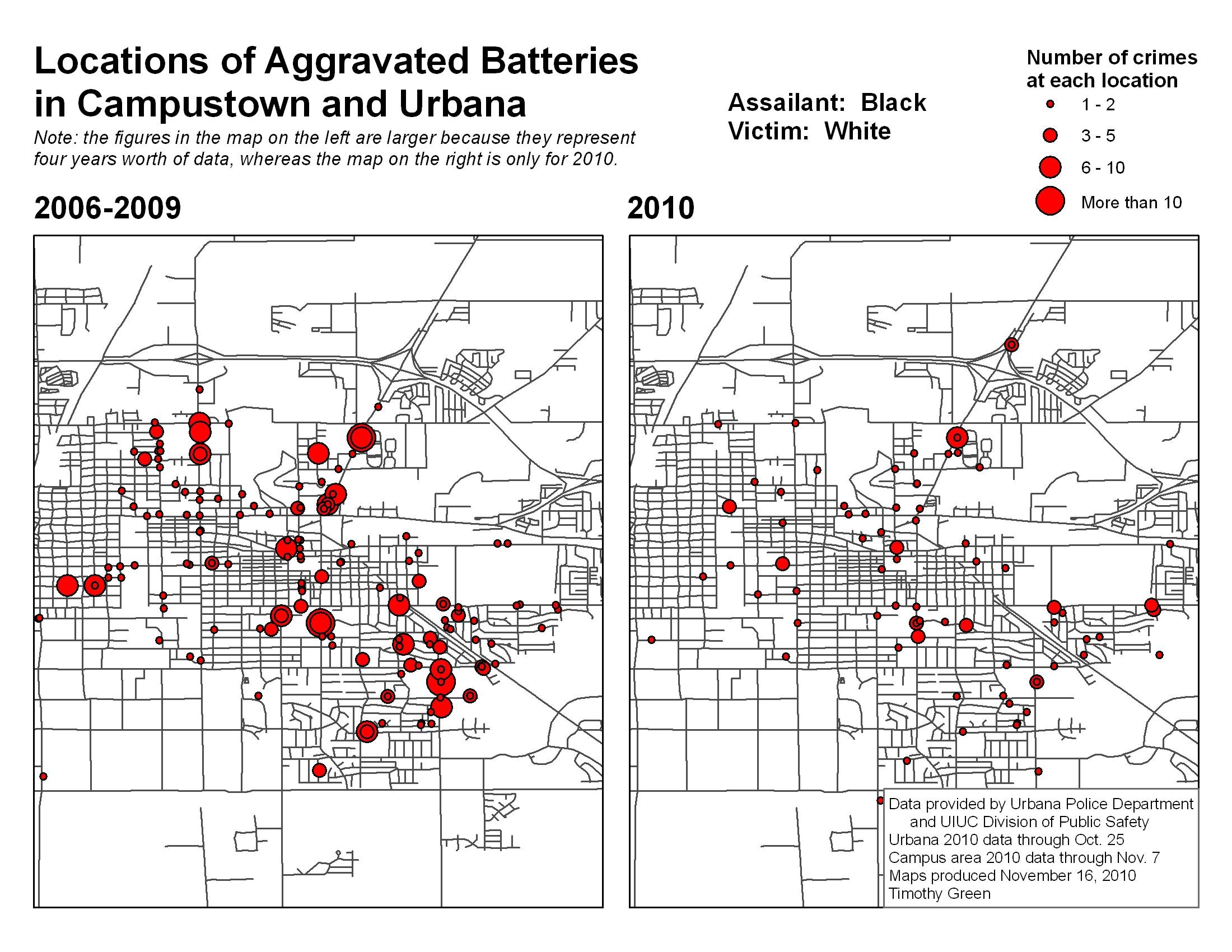
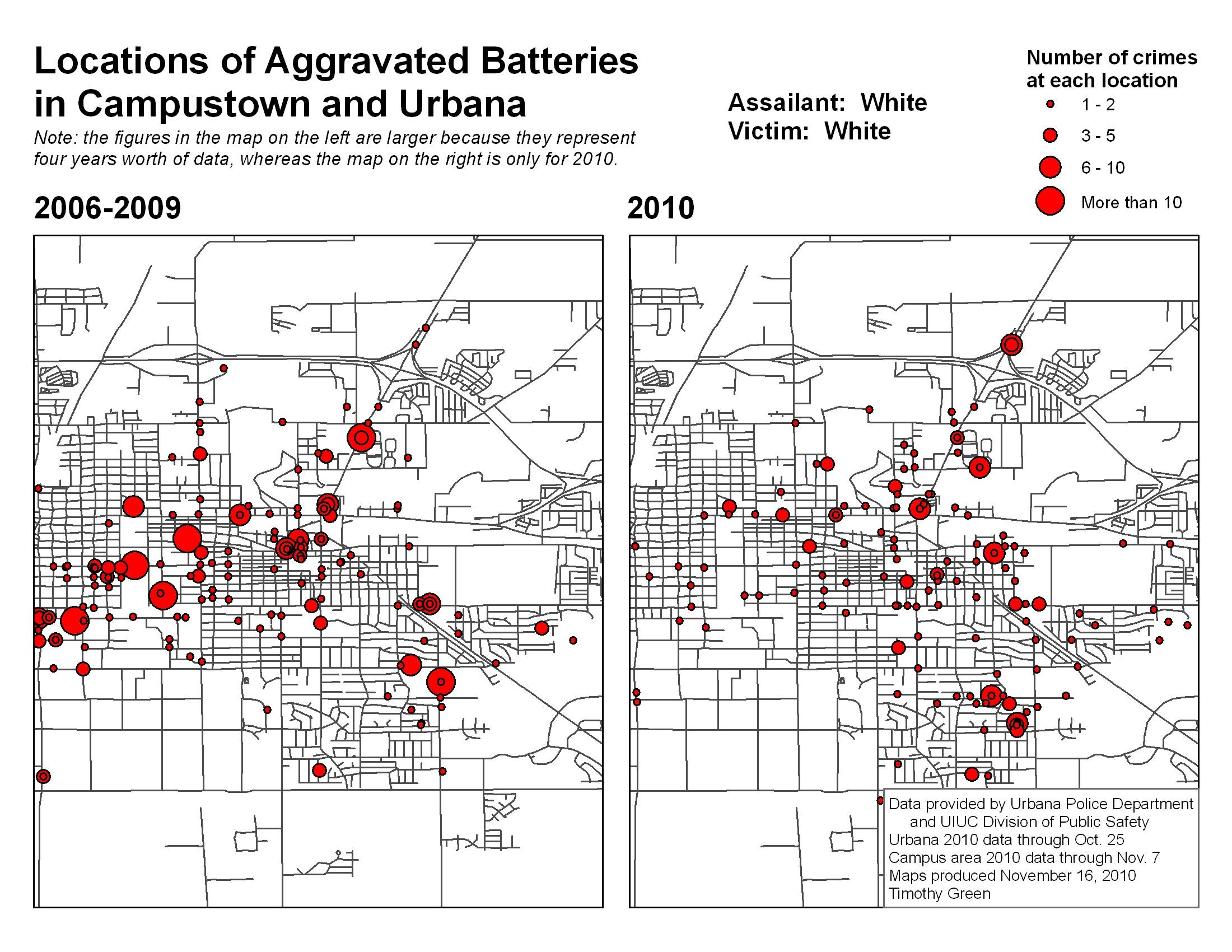
Below, note the locations of white-on-white crimes.
And, finally white-on-black aggravated batteries: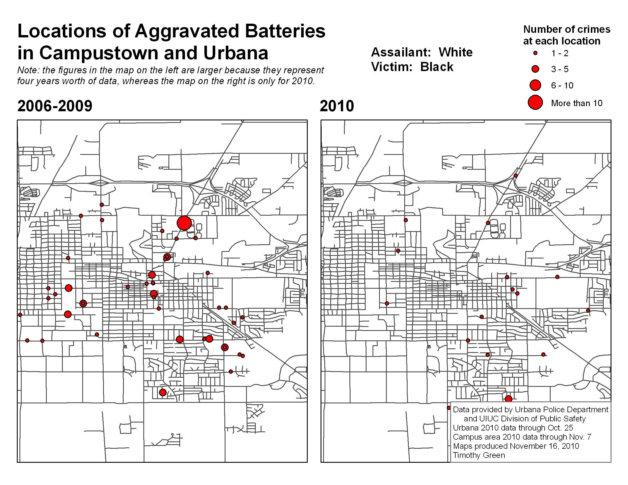
Here is the year-to-year data from Campustown specifically:
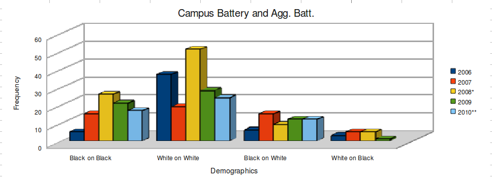

According to these numbers, there doesn’t appear to be a measurable increase in battery and aggravated battery incidents on campus this year, nor have there been more incidents of a particular demographic combination (although Asian on White incidents are up fourfold this year — a trend to watch!). As I noted last week about the Urbana statistics, the most surprising thing to me is how consistent the statistics are from year to year.
And, finally, the CPD announced Monday (and the DI filed a report as well) that you can now view a map of crimes in Champaign on CrimeReports.com. Obviously, it won’t tell you the demographics of victim and assailant, but it’s a way to keep track of the locations of recent crimes.
Hopefully, this information is useful to you. Please ask questions in the comments if something is unclear. Again, a million thanks to Tim Green for compiling the maps.