


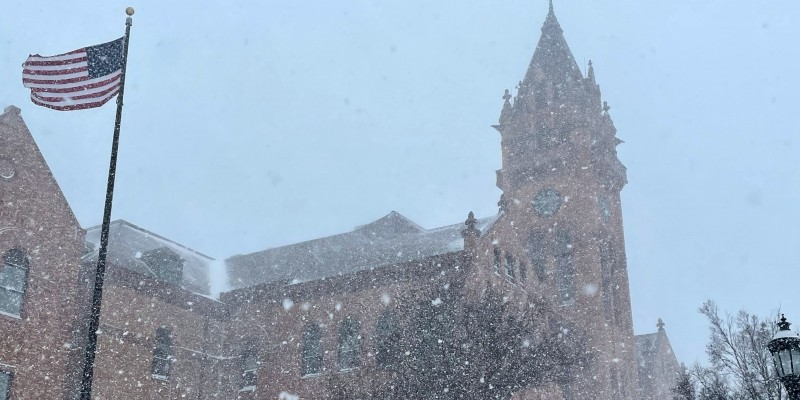
Sometimes all it takes is turning the page on the calendar. The recent snowstorm in Central Illinois came on the heels of one of the quietest, driest Januarys on record in Champaign-Urbana.
Across East-Central Illinois, it was the 7th driest January out of 130 years of record keeping. Champaign-Urbana recorded a modest 0.63″ of total precipitation for the entire month, well below the already relatively dry January average of 2.31″. Only February comes in drier annually.
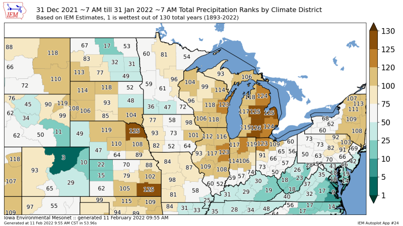
Image from Iowa Environmental Mesonet.
For that reason January wasn’t just dry, it was almost exclusively colder than average. But, there has been one difference this year compared to years past. It’s been cold, but we’ve mostly gotten by having just one or two really cold days before flipping back to fairly mundane January cold air.
Have you noticed you’ve not being hearing as much about the dreaded polar vortex this winter? That’s because the polar vortex — a jet stream that circulates around the arctic 365 days out of the year — has been near record strength all winter.
When the polar vortex is strong, we don’t talk about it across the Lower 48. At it’s strongest, the polar vortex tightly hugs the arctic, keeping it’s bitterly cold air locked in place. It’s when we see a weakening of the polar vortex that it looses it’s grip on the arctic, begins to wobble around, and at times allows a lobe of that extreme cold to plunge into the Midwest. That is how we end up with those long stretches of frigid air with consecutive days of sub-zero conditions across Central Illinois. The good news is, the polar vortex continues to be extremely strong as we head into mid-February, meaning the odds of any long-lasting extreme cold are quite low for the remainder of winter.
So what’s in store for the rest of winter? Last week’s snow storm was not a change in the pattern, and was actually somewhat of a fluke. The same jet stream alignment that’s kept us in this repetitive pattern of “shots of cold air and flurries” continues to hold on across North America. The heavy snow we saw on February 2nd and 3rd was the result of a stalled frontal boundary — not an intense area of low pressure and more classic Midwest storm system.
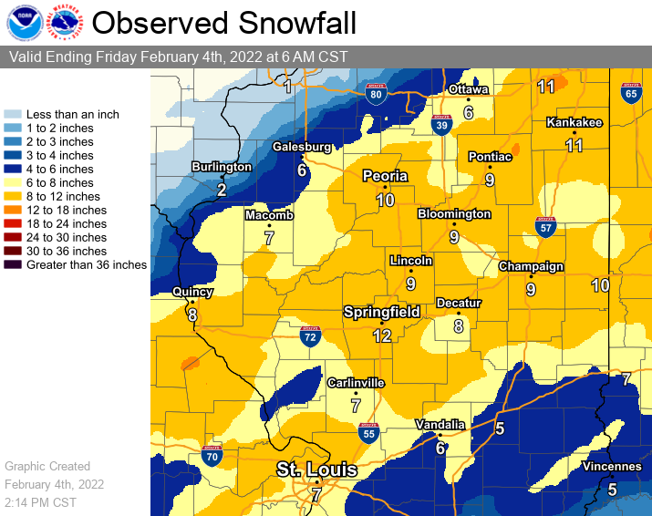
Image from National Weather Service.
Instead, this was what we call a long-duration “over-running moisture” event. Cold, dry air is really dense compared to warm, humid air. That might seem counter-intuitive when you think of how heavy those hot and muggy summer days can feel, but cold, arctic air is heavy like molasses. Think of last week’s polar front like molasses, oozing across Central Illinois. Warm and humid air streaming northward from the Gulf of Mexico runs into this atmospheric molasses and runs up over the top of it. As that warm and humid air rises over the cold, dry air, it condenses into clouds and precipitation. The precipitation then falls from the clouds, through the cold, arctic air near the ground and accumulates as snow. Do this for 36-48 hours consecutively and you end up with a foot of snow — more in some places across Central Illinois!
This type of over-running moisture event happens all the time in the spring and fall. It’s how we end up with those multi-day stretches of gloomy, dreary weather with light rain that sends our collective moods into the dumpster. This time however, we did it with sub-freezing air near the ground and accumulated much of the precipitation as snow.
Next week, an intense storm system is expected to sweep through the Midwest — a more classic late-winter or early-spring storm system with snow on the north side of the storm track, and severe storms to the south. For now, early guidance says Champaign-Urbana will be on the warm side of this storm missing out on another round of snow. It seems more likely that we’ll see rain, and perhaps even hear a rumble of thunder around February 16-17.
From here, most indications say that we’ll begin our slow journey toward spring through late February and early March. Long-range weather models are hinting at the long-awaited breakdown of the recent blocked jet stream pattern, shifting toward a more spring-like background state that would have more mild, and seasonally active weather in store locally.
Another week or so of relatively quiet weather, before I’d start expecting a ramp-up in storm systems and heavier precipitation events across Central Illinois in late February into March.
Andrew operates Chambana Weather, where he publishes daily weather information for Champaign-Urbana and surrounding communities. He also serves as Senior Meteorologist with Nutrien Ag Solutions at Research Park, focused on domestic and international weather and its impact on agriculture.
Champaign-Urbana monthly climate statistics are courtesy of the Illinois State Water Survey.