


We’re quickly approaching the midway point of the 2021 summer season, a season that’s worn a lot of different faces here in Central Illinois. What’s your feeling so far? Everyone loves to compare the summer and winter of today with those of their youth — are we hot enough? Stormy enough? Muggy enough to match those childhood memories?
A lot of the story is lost when you look at the macro, but let’s start with the big picture. From June 1st to July 12th, East Central Illinois is on pace for a top 15 wettest summer on record (out of 129 years of records). For the same period, temperatures in East Central Illinois have been a little warmer than the average pace, but only good for a top 40 or top 50 summer. The rain feels like the story here, right?
It wasn’t always! Through the first half of June much of Central Illinois was experiencing a top five driest start to the summer (again, out of 129 years)! Heat set in early and there wasn’t much rain to speak of across the entire Midwest during a time when we should be seeing our climatological peak in rain and thunderstorm activity regionally. The climatological peak severe weather season runs through the month of June, and the 2021 season will go down as one of the quietest on record in the state of Illinois.
So how did we pivot from top five driest to top ten wettest? The same way that we’re seeing it happen more and more often here in the Midwest as we observe changes in our climate. When we look at observed changes in annual weather patterns over the last few decades one thing is certain in the Midwest — we’re seeing more rainfall, but we’re also seeing more of it in heavy doses. In essence, while the average amount of rain that we see each year is climbing slowly, it’s a dramatic increase in the amount of excessive rainfall events that is most noteable. Heavy precipitation events, defined as a 2-day precipitation event that should only be expected once in every five years, have increased by a little over 40% across the Midwest.
You may not notice the gradual change in average annual precipitation, but I’d be willing to bet you have noticed the flooding of our basements and farm fields that has become all too routine. How does this happen?
There are a couple factors. We are noting a rise in the annual temperature here in the Midwest, but we’re also observing an increase in the total amount of moisture in the atmosphere. Our days are getting warmer, but they’re getting muggier faster. The total number of days that we surprass 90-degrees in Central Illinois hasn’t changed all that much, but we have seen an increase in the amount of muggy overnights where the low temperature does not drop below 70-degrees. It takes longer for a humid air mass to warm up during the day, but it also takes longer for it to cool at night. Simply put, more moisture in the atmosphere makes for more efficient showers and storms.
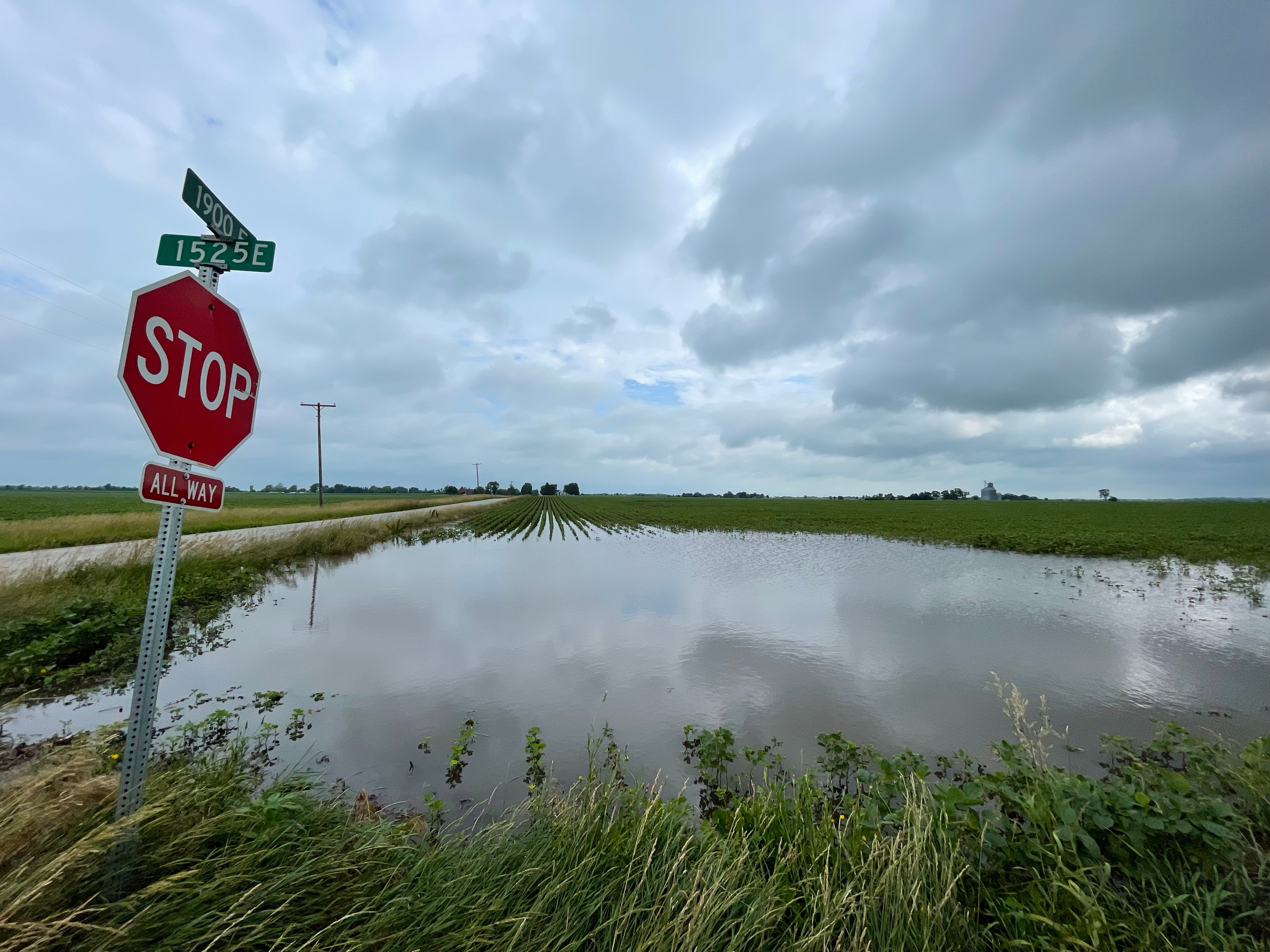
But how do we end up with these excessive rainfall events that produce swaths of 3″ to 6″ of rainfall over a couple of days, such as the weekend of June 25-28 which effectively flipped this summer from dry to wet over a 96 hour period?
Another factor in the evolving climate across North America has been an increase in blocked jet stream patterns — when the jet stream finds itself bunched up and unable to progress over a 10 day period. A wavy, blocked jet stream leads to weather extremes such as heat waves, or arctic outbreaks as large air masses are displaced and then parked in place. The same wavy, stuck jet stream that produced a several day period of record breaking heat across the Pacific Northwest produced a several day period of thunderstorms and excessive rainfall in the Midwest.
The extreme rainfall events that we see in Central Illinois often follow the same mold. A frontal boundary stalls across the region, a prime focal point for thunderstorm development. The jet stream, instead of progressing and helping move the front along, parks itself overhead such that we’ve got a parade of upper-level disturbances to help encourage rain and thunderstorm development along that stationary front. The cherry on top of a stuck jet stream and surface pattern that can’t help but produce multiple waves of storms is an atmosphere that is holding increasing amounts of water vapor available to be rained back to the surface.
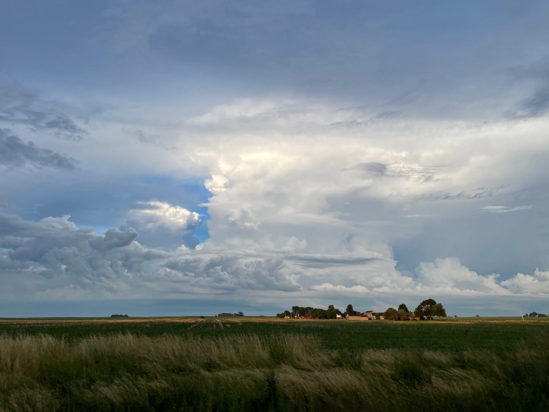
Photo by Andrew Pritchard.
I’m trying to avoid a climate change soapbox — I’m a meteorologist, not a climatologist. I forecast the weather, others have much more expertise in studying the climate as a whole —but these are observed changes. Here in the Midwest we’ll see our share of heat waves, we always have. But that’s not where the evolving climate normals are seeing the biggest change in our backyards. Instead, we’ll likely see more springs and summers like this one, with periods of dryness and short-term drought mixed with periods of extremely heavy precipitation.
As the jet stream across North America evolved through late June, Central Illinois remained primed for daily shower and thunderstorm activity. Every day but one from June 19th to July 1st saw measurable rainfall, with thunder being reported on about half of those days. Though it’s been a quiet severe weather season across the Midwest, June 25th saw a couple brief tornadoes reported near Decatur and the 26th saw a more widespread outbreak of strong storms producing mostly strong winds as they marched across central Illinois during the evening.
June 2021 finished with 7.24″ of total precipitation, 2.66″ above the average of 4.58″. Of that 7.24″, a little over 5″ of it fell during the four day period June 25-28, flooding roads, rivers, farm fields, and basements across Champaign County.
July 2021 is already on its way to a wetter-than-average finish, and sticking to the script much of it fell in just one day. Through July 12th, 2.61″ of rainfall has been measured in Champaign-Urbana, but 2″ of that fell on July 1st. The remaining 0.61″ fell from showers and storms on the 8th, 11th, and 12th — a period that has felt more cloudy and gloomy than anything.
While the temperature story has been far less impactful than the precipitation story, it has been interesting to note the rather hot start to June followed by the lack of heat as we move through the month of July. June 12th has been the hottest day of 2021 so far in Champaign-Urbana with a high of 95 degrees. There were four days with high temperatures in the 70s in June, with every other day topping out in the 80s or 90s. June 2021 finished 1.8 degrees warmer than average.
July is off to a cooler start, 2.5 degrees below average through July 12th and still searching for that first 90-degree day.
So finish the story for me, where do we go from here?
I don’t think it’s very far. I don’t see any sign that the transport of moisture from the Gulf of Mexico is going to be shut down, meaning this muggy, moisture-laden airmass is probably here to stay. That means my confidence in us avoiding any meaningful summer drought in Central Illinois is increasingly high, but it may be at the expense of continued rounds of rain and thunderstorms through the end of July and into August that may at times produce excessive rainfall totals. Summer storms also come with their own inherent severe weather risks including damaging winds and hail (it’s been just over one year now since the July 11th hailstorm that caused damage to my home and many others across Champaign-Urbana) so it is perhaps a rather vulnerable position to find ourselves in.
I think we’ll see another wave or two of big summer heat and 90-degree days in Central Illinois, but I think it will be in smaller, shorter doses with much of the big time heat setting up shop to our west, over the western U.S. and Northern Plains. Folks from California to the Dakotas up to the Canadian Prairie are likely to be sweating it out for much of the summer.
Instead of heat in the Midwest, the story will likely continue to be rain and thunderstorms. Hopefully not of the historically significant variety such as we saw June 25-28.
My “Last Half of Summer 2021” forecast would be continued wetter-than-average conditions with increased potential for heavy rainfall events and temperatures to continue near average. It’s summer, it will be hot sometimes, but I also think we’ll see another stretch or two like the last few days with cooler, cloudy weather in our backyard.
Enjoy it! Soak up that sunshine, and remember to keep valuable items in your basement elevated off the floor.
Winter will be here soon enough.
Andrew operates Chambana Weather, where he publishes daily weather information for Champaign-Urbana and surrounding communities. He also serves as Senior Meteorologist with Nutrien Ag Solutions at Research Park, focused on domestic and international weather and its impact on agriculture. Check out his recent vlog documenting the weekend of storms below:
Champaign-Urbana monthly climate statistics are courtesy of the Illinois State Water Survey.
Top photo by Andrew Pritchard.