


Summer 2023 has been a time of frequent stress for meteorologists and farmers alike in the Midwest. Rain was sparse early in the growing season, and when it finally arrived during the summer it came with the bite of 80 MPH winds. Wildfire smoke has made several appearances in central Illinois, at times making the air too unhealthy to safely breathe outdoors. It hasn’t all been summer doom and gloom of course, and there’s plenty to look forward to as we head into fall in the Midwest so let’s talk about it! What made this summer the way that it was, and where are things headed this fall?
The biggest storyline in the weather world this spring and summer has been the transition out of La Nina and into El Nino. El Nino and La Nina are the warm and cold phases of the El Nino Southern Oscillation, or ENSO. We’re talking about Pacific Ocean waters and trade winds along the equator off the coast of South America. When trade winds are stronger along the equator, they dredge up cooler waters from deep below the surface – this is La Nina. When trade winds are weaker, they allow the opposite, warmer ocean waters pool near the surface – this is El Nino. These two contrasting phases have a very different impact on the jet stream, which changes the weather patterns we see across North America. Finally, the impacts of La Nina and El Nino on our jet stream and weather patterns is typically strongest during the cold season, as we head deeper into fall and winter with less noticeable effects in the summer months.
As we transitioned out of La Nina and into El Nino late spring into early summer, we entered a period of very low predictability for weather forecasting. We speculated that with a growing El Nino we might expect to see a stronger, more consolidated jet stream across the Central US – because this is what has typically happened in the past. A stronger, more consolidated jet stream should lead to more storm systems, with more storm systems leading to heavier rainfall. Where exactly the active storm track setup of course, we didn’t really know with any sort of
certainty, but we could again speculate that the Midwest should be in line for a lot of this action. The major severe weather outbreaks centered on Illinois on March 31st and April 4th added confidence to these forecasts. Persistence weather forecasting is the idea that the current weather pattern will continue – i.e. “it’s active now, and should continue to be active”.
The state of weather forecasting is that we’re getting pretty good at picking up the major pattern drivers season to season, i.e. El Nino, La Nina, or other major atmospheric or oceanic circulations. What we’re not very good at yet, and where a lot of research is being done, is figuring out what the smaller wild cards may be that could impact the atmosphere on shorter week to week intervals.
The truth is, sometimes there are often many different things going on across the entire Northern Hemisphere that are impacting the weather we experience week to week right here in Central Illinois. Sometimes a rapidly intensifying El Nino means you should expect to see a strong jet stream with an active storm track. Others, a “blocking pattern” in the eastern United States that went largely unforecast takes that strong jet stream and literally blocks it from entering the Midwest, sending the active storm track deep into the Southern US. That’s what happened in late April, May, and June 2023.
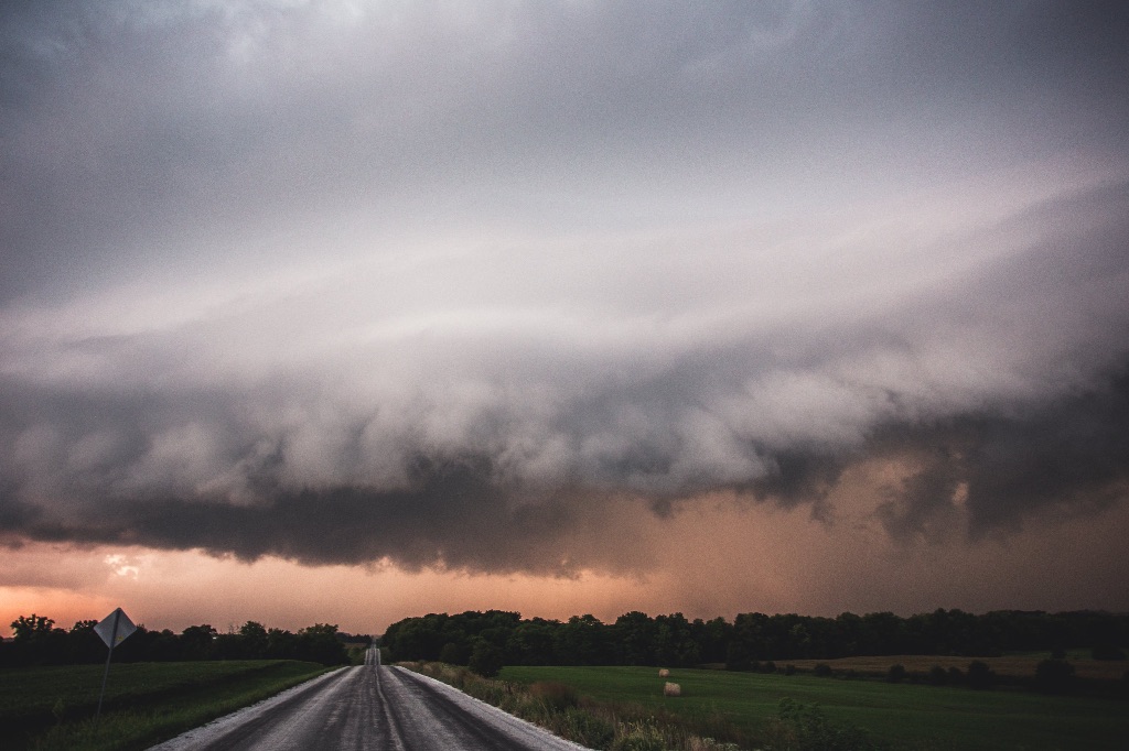
The storm season was one of the most active in the last 20 years during the April to June 2023 time frame, but with the jet stream blocked up across the eastern half of the US, every storm system played out the same. As Midwestern meteorologists peered into weather forecast models they told the same story – “dry this week, but next week the active storm track will shift into Illinois”. A week later, the same blocking pattern was still there, sending the storms south while we were becoming increasingly dry locally during what’s historically our wettest time of the year.
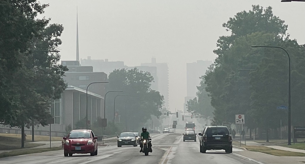
Flash drought began to quickly develop across the Midwest as hot temperatures and plenty of sunny, hot days evaporated moisture from early spring rain out of the soil. At the same time, thick smoke from Canadian wildfires began to filter into the region blocking out the sun and forcing us indoors at times due to poor air quality. Meteorologists and farmers alike across the region were not having a good time.
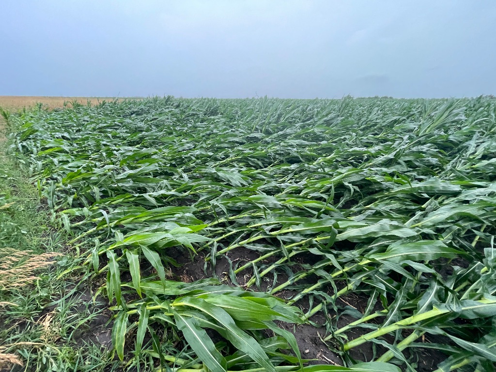
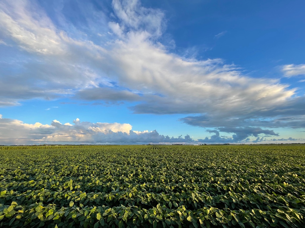
The pattern broke in late June as a line of severe thunderstorms producing 80 MPH winds blasted through the area. The results were damaged crops, fallen trees, and many communities without electricity for several days or more. A stormy first ten days of July did a lot of work to bring crops back from the brink across Central Illinois, and finally allowed local gardeners to take a day or two off from relentlessly watering their gardens. Still, the month finished on the dry side with a run of summer heat late in the month that had high temperatures well into the upper 90s. The drought across east-central Illinois was mostly remedied by more frequent rain and thunderstorms in the month of August which finally brought to an end the streak of months with below normal precipitation that stretched back to April.
Extreme heat made a final push in late August with a record high temperature of 98 degrees being set in Champaign-Urbana on August 25th. Looking back at Summer 2023 you could sort of oversimplify it as a summer that started off hot, dry, and stressful and then transitioned into a pretty typical Midwestern summer by late July and August. “So, what’s to come this fall and beyond, Mr. Meteorologist – and don’t tell me you don’t know!”
We don’t know. El Nino figures to play a major role in the weather across the US the deeper we head into fall and winter. While this does give us a vague mental picture of what the jet stream may lean toward during the entire fall and winter seasons, it also introduces a lot of weather forecast uncertainty.
September got off to a hot start with several 90 degree days during the first week. The second week of September already looks a lot different with much cooler, almost chilly air spilling into the Midwest and lots of sunny, blue skies and dry days on the near horizon. At this time of the year, dry weather is mostly good news for farmers as they begin to think about harvesting their crops. This cool, dry weather pattern looks like it will hold on deep into the month of September here in Central Illinois.
Looking deeper into the fall we again begin to expect a stronger, more consolidated jet stream. You may know where I’m heading with this, then. It’s very possible that after a mostly dry September we could make a fast pivot into an active, stormy October and beyond. The storm track figures to be active, and a look back at historical examples of El Nino shows the storm track should at times run through our backyards. Does that mean we’ll see a lot of rain, severe weather, or eventually heavy snow? That’s what we don’t know. As we look at the atmosphere on the scale of several months we can do a fair job of estimating the background state of the atmosphere, but we’re not talking about forecasting
individual storm systems with specific weather impacts in our backyard. That kind of thing is still only possible on a seven to ten day scale.
As I write again in early October I expect to be looking back on a September that finishes with temperatures cooler overall (even with that run of heat in the first week – I expect it to be quite cool at times mid-month!) with precipitation likely below average. September is typically a drier
month compared to the summer, and the outlook for the next week or two continues to trend drier compared to September averages. Beyond that, I suggest we buckle up. It’s going to be an active fall and winter across much of the Central U.S. and at times, that storm track should run through C-U.
Andrew operates Chambana Weather, where he publishes daily weather information for Champaign-Urbana and surrounding communities. He also serves as Senior Meteorologist with Nutrien Ag Solutions at Research Park, focused on domestic and international weather and its impact on agriculture.